Projects that use GeoTrellis
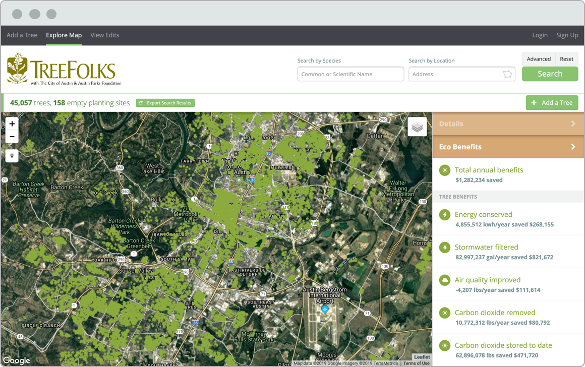
OpenTreeMap
OpenTreeMap allows urban foresters to map trees from a phone or tablet, calculate ecosystem benefits, and more.
Different communities have different tree planting needs. This tree prioritization demo enables users to combine multiple datasets and set weights to generate a list of priority tree planting sites. Datasets include household income, percent tree canopy cover, and impervious surface among others.
Looking for a custom solution?
We have nearly ten years of experience helping organizations accomplish their goals.
Contact us